

DJI Mavic 3 Multispectral
Revolutionize Your Aerial Surveys with DJI Mavic 3 Multispectral
The DJI Mavic 3 Multispectral is built for professionals who rely on fast, precise aerial data. Whether you're mapping orchards, assessing environmental impact, or managing natural resources, this drone gives you the tools to get it done with accuracy and efficiency.

See Beyond the Surface with RGB + Multispectral Camera System
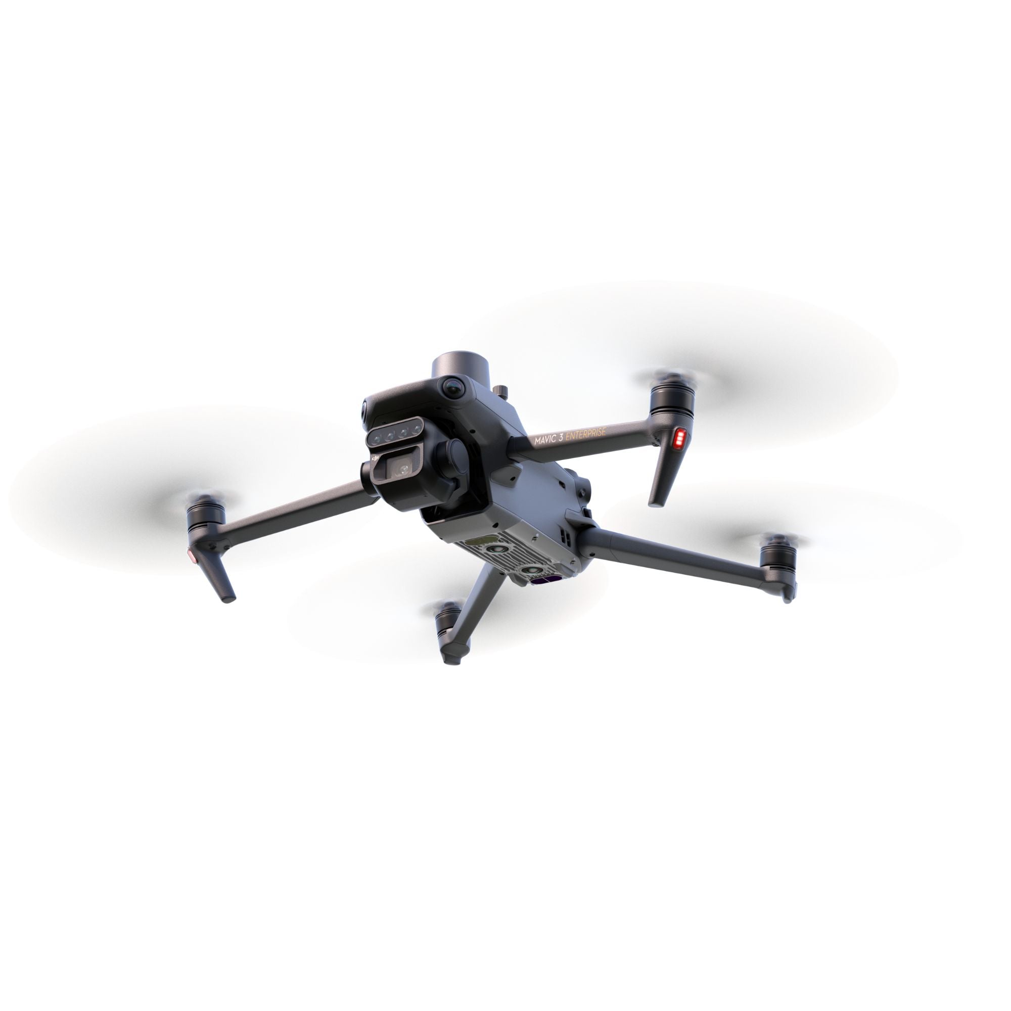
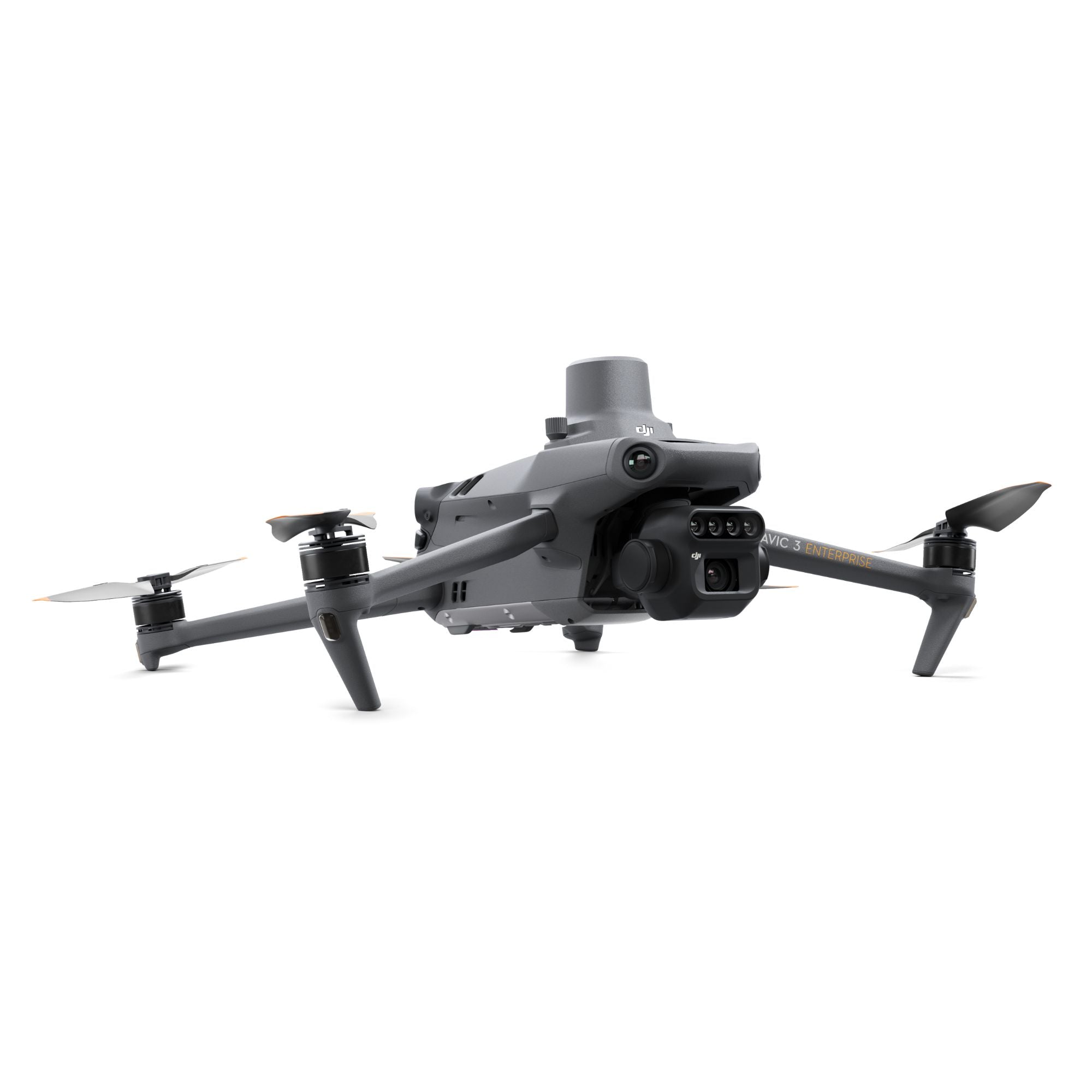
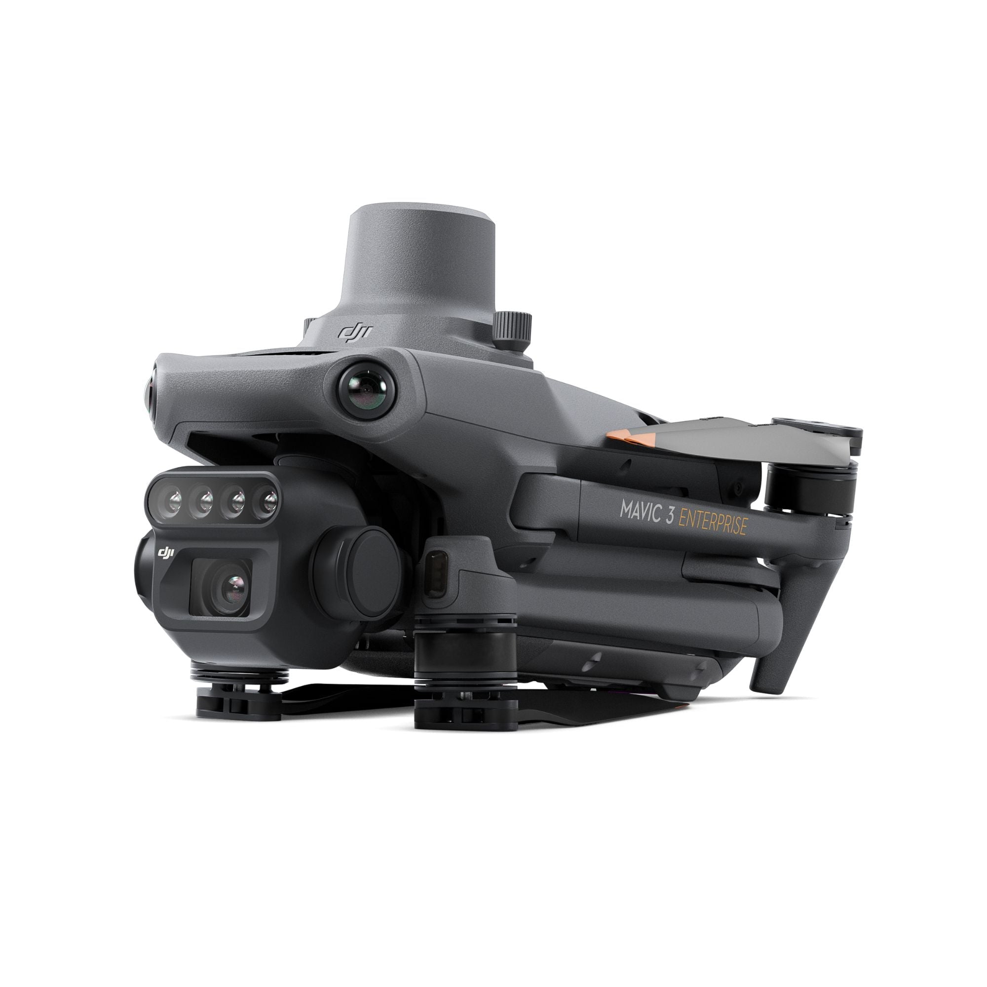
Equipped with a 20MP 4/3 CMOS RGB camera and four 5MP multispectral cameras, the Mavic 3 Multispectral captures stunning visuals and crucial vegetation data. Its ability to process green, red, red edge, and near-infrared spectrums makes it a game-changer for precision agriculture and ecological monitoring.
Every detail is crystal-clear, making it easier than ever to analyze crops, manage resources, and monitor changes in the environment.
Integrated Sunlight Sensor for Accurate Data
A built-in sunlight sensor measures solar irradiance and stores it directly in image files. This feature ensures data consistency over time, delivering optimized NDVI results for smarter decision-making.
With adaptive lighting adjustments, you can rely on this drone to deliver precise analytics under any lighting conditions.
Pinpoint Accuracy with RTK Integration
The Mavic 3 Multispectral includes an RTK module for centimeter-level positioning. The RTK module syncs with the flight controller and cameras, allowing accurate mapping without ground control points. Save hours in the field and reduce post-processing time.
Whether you're mapping resources or conducting agricultural surveys, this system guarantees unmatched accuracy.
Fly Longer, Cover More
Engineered for efficiency, this drone offers up to 43 minutes of flight time per charge. It can cover up to 200 hectares in one flight, making it an essential tool for large-scale surveys.
Fast charging with a 100W Battery Charging Hub or an 88W direct charger ensures minimal downtime, keeping you productive throughout the day.
Go Further with Stable O3 Transmission + Obstacle Avoidance
The O3 transmission system delivers stable, interference-free signals with a range of up to 15 km. Advanced obstacle sensing and terrain-follow technology ensure safe operations, even in complex environments.
From long-range scouting to close-up monitoring, the Mavic 3 Multispectral is built for consistent performance.
DJI Mavic 3 Multispectral Specs Overview
| Component | Specs |
|---|---|
| RGB Camera | 20MP, 4/3 CMOS sensor |
| Multispectral Cameras | 4×5MP (Green, Red, Red Edge, NIR) |
| RTK Module | Centimeter-level accuracy, GCP optional |
| Flight Time | Up to 43 minutes |
| Coverage Area | ~200 hectares per flight |
| Transmission Range | 15 km with O3 system |
| Obstacle Avoidance | Omnidirectional sensing |
| Software Integration | DJI Terra (3-month license), SmartFarm |
Mapping Applications with Mavic 3 Multispectral
This drone is more than just a tool; it's a solution designed to meet the demands of various industries. Its advanced imaging capabilities and precision flight features make it a valuable tool across multiple sectors.

- Map orchards for precise crop planning.
- Scout fields to identify problem areas.
- Create prescription maps for targeted crop spraying.
- Optimize irrigation and monitor crop health.
- Detect pests early and improve yield efficiency.
Environmental Management:
- Monitor ecological changes in real-time.
- Map natural resources for conservation efforts.
- Assess vegetation health with accurate data.
- Track environmental shifts for better decision-making.
Natural Resource Management:
- Conduct land assessments with precise imaging.
- Allocate resources efficiently using actionable insights.
- Survey forests, wetlands, and urban green spaces.
Research and Conservation:
- Support studies in biodiversity and climate research.
- Document conservation efforts with reliable data.
- Analyze environmental changes for better outcomes.
Whatever your industry, the Mavic 3 Multispectral empowers professionals to work smarter, faster, and with greater precision.
Value-Added DJI Terra & SmartFarm Access
Get a free 3-month license to DJI Terra for professional 2D/3D mapping. Also includes a 1-year subscription to DJI SmartFarm to help you turn raw multispectral data into action.
Combining innovative imaging, extended flight time, and comprehensive protection, the Mavic 3 Multispectral is the ultimate tool for aerial surveying. Elevate your organization's drone program today and experience a new standard in precision and performance.